
Istanbul has an excellent transportation system utilizing almost of all the known forms of public transport. Within the city limits one can ride on buses, metrobuses, subway trains, suburban trains, trams, funiculars, cable cars, ferries, fast ferries, sea buses and sea taxis. There are numerous modes of public transport in the city and most of them are linked to one another. We use a system called ISTANBULKART which is a contactless electronic card.

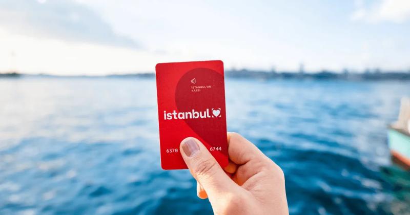
Regular Istanbulkart
The regular Istanbulkart is sold at ticket booths near major transportation hubs like Eminönü, Taksim and Beşiktaş. Also, it’s widely available at the newspaper stands and kiosks, and you can buy them from the self-service refill points at some of the metro stations and transfer points as well. The regular fare is 46,20 ₺ and after you make your first transfer it reduces to 34,40 ₺.
You pay a fee of 165 ₺ for the card itself, then you can load as much credit as you’d like on it using the self-service kiosks named as (ISTANBULKART DOLUM NOKTASI, meaning Istanbulkart refill point).
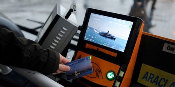
To use your Istanbulkart, you will need to place the card on the electronic readers placed on top of the turnstiles. You will hear a beep sound which signals that you are okay to pass. You can monitor the remaining credit from the digital screens on the turnstiles after each use.
Student Istanbulkart
This is the card that will be the one you can apply for with a student certificate from university. This card is the cheapest way you can travel around Istanbul. The fare for students is only ₺22,55 and after the first transfer it reduces to ₺11,21. We recommend you get it as soon as possible. The Student Istanbulkart costs 140 ₺.
You need the following during your application:
-
Student Certificate
-
1 Photograph (passport photo)
-
YOK Number
-
Passport
For details: https://www.iett.istanbul/en
You can also reach the current fares from here: https://www.iett.istanbul/tr/main/pages/iett-toplu-ulasim-ucret-tarifesi/42
Transportation System
Buses: Istanbul’s buses connect residential areas, university campuses, metro stations and ferry terminals. Check the route number and destination displayed on the bus before boarding, and use your Istanbulkart to pay.
Several bus routes serve stops around İTÜ’s Ayazağa campus, including İTÜ Rektörlüğü. Useful examples include:
| Bus | Route |
|---|---|
| 29B | Fatih Sultan Mehmet – 4. Levent Metro |
| 29D | Ferahevler – Kabataş |
| 29E | Maslak Gazeteciler Sitesi – Beşiktaş |
| 29Ş | İstinye Dereiçi – Şişli |
| 40B | Sarıyer – Beşiktaş |
Choose your stop according to the campus entrance you need, and check the direction before boarding. These services are listed at the İTÜ Rektörlüğü stop; departure times and route variations should be checked before travelling.
You can also reach Ayazağa campus using the M2 metro, getting off at İTÜ–Ayazağa.
For routes and departure times: İETT
Metro: Istanbul’s metro network connects major residential areas, business districts, university campuses and both international airports. It has expanded considerably beyond the lines listed in older guides.
The main metro routes include:
| Line | Route |
|---|---|
| M1A | Yenikapı – Atatürk Havalimanı |
| M1B | Yenikapı – Kirazlı |
| M2 | Yenikapı – Hacıosman, with a branch to Seyrantepe |
| M3 | Bakırköy Sahil – Kayaşehir Merkez |
| M4 | Kadıköy – Sabiha Gökçen Havalimanı |
| M5 | Üsküdar – Sultanbeyli |
| M6 | Levent – Boğaziçi Üniversitesi / Hisarüstü |
| M7 | Yıldız – Mahmutbey |
| M8 | Bostancı – Parseller |
| M9 | Ataköy – Olimpiyat |
These routes are listed by Metro İstanbul, which publishes station information, operating hours and service announcements.
The M11 additionally connects Gayrettepe, İstanbul Airport and Halkalı. For airport journeys, use M11 for İstanbul Airport (IST) and M4 for Sabiha Gökçen Airport (SAW).
Getting to İTÜ Ayazağa Campus
The most useful metro line for İTÜ’s Ayazağa campus in Maslak is M2. Get off at İTÜ–Ayazağa station.
-
From Taksim, Şişli–Mecidiyeköy, Gayrettepe or Levent: Take the M2 towards Hacıosman.
-
From Hacıosman or Darüşşafaka: Take the M2 towards Yenikapı.
Check the destination displayed on the platform before boarding. Seyrantepe is on a separate branch reached by transferring at Sanayi Mahallesi; stay on the Hacıosman service when travelling towards İTÜ–Ayazağa from central Istanbul.
Useful Transfer Stations
| Station | Connection |
|---|---|
| Yenikapı | M2, M1A/M1B and Marmaray |
| Gayrettepe | M2 and M11; walking connection to Zincirlikuyu Metrobus |
| Levent | M2 and M6 |
| Taksim | M2 and F1 funicular to Kabataş |
| Ayrılık Çeşmesi | M4 and Marmaray |
Follow the signs for the connecting line and allow time to walk between platforms.
What Is Marmaray?
Marmaray is a suburban railway that crosses beneath the Bosphorus, connecting the Asian and European sides. It is separate from the metro but provides useful connections. For example, you can change from M4 to Marmaray at Ayrılık Çeşmesi, then transfer to M2 at Yenikapı to continue towards İTÜ Ayazağa.
Using the Metro
Use your İstanbulkart at the station entrance gates. Before travelling, check your destination, transfer stations and the first or last departure for each service—especially for late-night journeys.
For line information and service announcements: Metro İstanbul
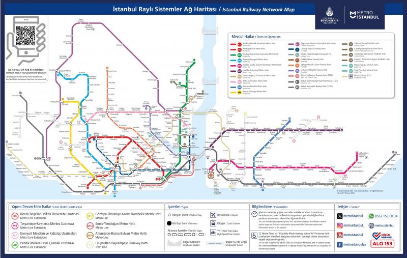
Funiculars and Trams: Funiculars are short, cable-operated railways that connect places at different elevations. Trams generally run along street-level routes and serve several stops.
Useful funicular connections include:
-
F1 Taksim–Kabataş: Connects Taksim Square with the Kabataş waterfront. At Taksim, you can transfer to the M2 metro; at Kabataş, you can connect to the T1 tram and ferry services.
-
F2 Karaköy–Beyoğlu, known as Tünel: Opened in 1875, this historic underground railway connects Karaköy with the upper end of the hill near İstiklal Street. The nostalgic tram along İstiklal Street towards Taksim is T2.
-
F4 Boğaziçi Üniversitesi/Hisarüstü–Aşiyan: Connects Hisarüstü with the Bosphorus waterfront at Aşiyan, with access to M6 at Hisarüstü and ferry services at Aşiyan.
Useful tram routes include T1 Kabataş–Bağcılar, T3 Kadıköy–Moda, T4 Topkapı–Mescid-i Selam, and T5 Eminönü–Alibeyköy.
For details and maps: Metro İstanbul
Ferries: Ferries are an inseparable part of Istanbul’s daily life and offer a scenic way to travel across the Bosphorus or along its shores. Before travelling, check the departure pier, destination and timetable carefully, as services vary by route.
Şehir Hatları publishes its ferry timetables, route maps and fares online. Check the fare for your chosen service, as ferry routes do not all have the same price.
For details: Şehir Hatları
Metrobus: Metrobus is Istanbul’s bus rapid transit system, covering approximately 52 kilometres with 44 stations between Beylikdüzü and Söğütlüçeşme. It connects the European and Asian sides and uses dedicated lanes for much of its route. The system operates around the clock, although individual services cover different sections.
Check the destination displayed on the vehicle before boarding. Buses may terminate at Beylikdüzü, Avcılar, Cevizlibağ, Zincirlikuyu or Söğütlüçeşme, so not every bus travels the entire route.
For İTÜ Ayazağa: Get off at Zincirlikuyu, follow the signs towards Gayrettepe M2 metro station, and take the M2 towards Hacıosman. Get off at İTÜ–Ayazağa. Allow time for the walk between Metrobus and the metro.
For details: İETT Metrobus Information
Minibuses: Minibuses are shared passenger vehicles operating along fixed routes. Check the destination displayed on the vehicle and confirm your stop with the driver before boarding. Carry Turkish lira in cash and ask about the fare and accepted payment methods; do not assume that every minibus accepts Istanbulkart.
Cable Cars: Istanbul has two municipal aerial cable-car lines: TF1 Maçka–Taşkışla and TF2 Eyüp–Piyer Loti. TF2 connects Eyüp with Pierre Loti Hill, a popular viewpoint overlooking the Golden Horn.
For details and operating hours: Metro İstanbul
Follow us